Field trip to Leluh ruins to gather GPS data
In an extended unit exploring latitude, longitude, tilt of the earth, solstices, equinoxes and possible astronomic alignments of ancient sites on Kosrae, the summer 2018 physical science class traveled to the prehistoric island capital of Leluh. Recent work by Richard, Shen, Hobbs, Wu, Jiang, and Beardsley (New Precise dates for the ancient and sacred coral pyramidal tombs of Leluh, 2015) date the oldest sections of tombs to circa 1310 A.D. Thus the city dates back to the 14 century and provides evidence of the existence of a nation state.

Although the class is specifically interested in whether Leluh aligns Finol Finkol (the highest mountain in Kosrae) and Menka with the rising summer solstice sun and the setting winter solstice sun, a secondary interest was whether portions astronomical alignments might exist within Leluh.
The class departed campus at 9:30 in two vehicles.


Crystalline basalt along the current entrance path.


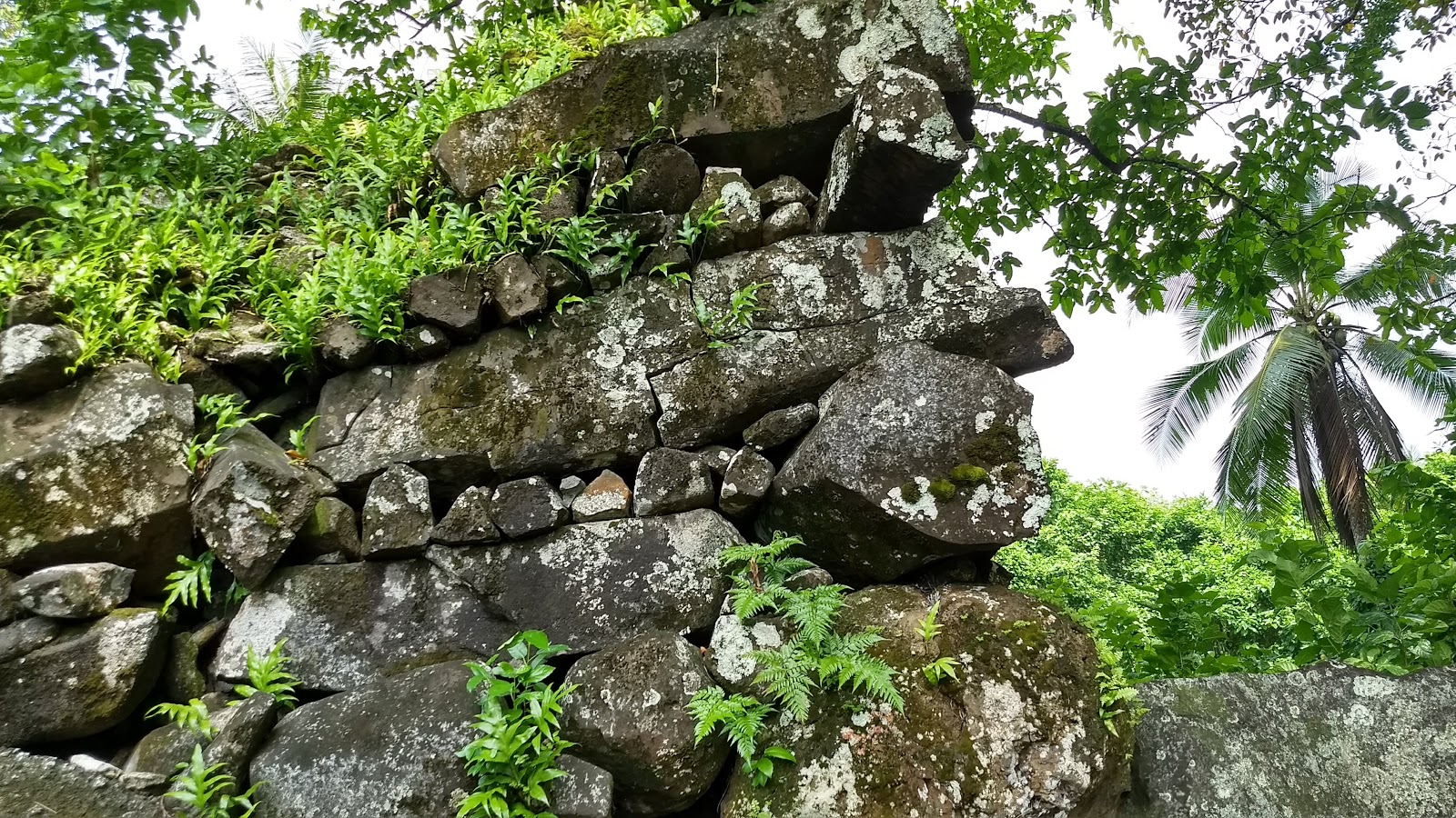
The tallest corner in Leluh on the far left. The Piper methysticum, seka (Pohnpeian sakau) pounding area just ahead.


The "kohnyah" tree, Ficus prolixa, is what is holding this corner together.

This large boulder is next to an areas with many seka (Piper methysticum) pounding stones. Conceivably this could have tumbled from the cornice off to the left, or the stone could have always been in this location. If the later, then the stone, which is basalt, had some significance.

Paul makes a GPS fix on the location of the boulder.

The Piper methysticum courtyard or plaze includes three races or runways of prismatic basalt. The pounding stones, which are numerous and may have been more numerous in the past, are between the the outer two runways. Walking between the runways is difficult if one has the Pohnpeian habit of not stepping on a "peitehl" - a sacred pounding stone. The local take is the prismatic basalt were benches and that Togurai - the king - sat with friends and drank seka in this "party area." Too many years of sakau on Pohnpei have my eyes seeing a different story. At the back of the above image is a canal on which seka was brought to this area. Behind me is the tallest structure in Leluh. I suspect that the Togusrai sat on wooden platform under sheltering thatch below the cornice. Getting seka up to the king from the plaza of "peitehl" would have been daunting: the stones are many and the "wie konoat" would have impeded moving seka out of the area. The columns are near on ideal for a bare foot bearer of seka to move quickly out of the area, bringing the cup to the king.

These Piper methysticum pounding stones are too small for the service to have been done using Hibiscus tiliaceus wraps. I cannot see how or where one would lay down the "wungwung" for squeezing. Perhaps they were squeezing, but my sense is that they were using some other process.

A cracked peitehl.

Why three lines? Oloiso, Serihso, and the now long lost line of the high priests of the traditional religion. Each line being served by their own line of peitehl. I know, this is Kosrae, not Pohnpei. But Pohnpei follows the leadership structure set in place by Isokelekel, a warrior from Kosrae who along with 333 fellow Kosraeans unseated the Saudeleur rulers in Pohnpei. Isokelekel was the first Nahnmwarki for Pohnpei, his son was apparently the first Nahnken. Isokelekel would have likely set up a system that paralleled that which he knew growing up on Kosrae.

I was once told that were the five Nahnmwarki of Pohnpei to meet, Madolehnihmw gets the first cup. Unless Togusrai were present, then he gets the pwehl, the first cup. Apparently his title was higher - which makes sense from an Isokelekel perspective. So three lines of basalt for three top royals: Nahnmwarki, Nahnken, and the top title in the religious line. Just my imaginings, based on zero facts and no research.


One must watch one's step to avoid accidentally stepping on a peitehl.


A raceway or runway for moving seka?

Palik is an expert on the ruins, and the class was deeply attentive to his explanations. For some students this was their first visit to Leluh.

Prismatic basalt makes a good bench.


Walking on the runway.


No idea if the marks are prehistoric or modern, probably modern?

Fahsuc, Nypa fruticans, is used for thatch on Kosrae and is seen here growing in one of the access canals. Leluh was accessed only by canoe, much as was Nan Madol. On the back right is a Ficus prolixa of great size and age. Large lizards, perhaps water monitors, are said to live there. No one goes there.


This peitehl is between the canal and the burial tombs. At least that was my perception - this is basalt and would not naturally occur in this location. Perhaps seka on the way to interment?

A GPS reading at Insaru Bat (tomb 2). The students were also making their own readings.

I became interested in whether the seka stone plaza was perhaps some sort of special alignment. I suspected that the plaza simply runs from the canal towards the tallest structure in Leluh, that there was nothing particularly special about the alignment. The ancient Kosraeans were navigators - Isokelekel and 333 warriors intentionally set out for Pohnpei. Navigation out here is stellar navigation, thus one can infer that the Kosraeans understood solstices and equinoxes. A GPS reading back at the seka stone plaza. This is the southwest end of the rightmost runway.

The rightmost runway, the large boulder seen earlier on the right.

At the northeast end of the runway, at the corner, is a curious and small cuboid basalt with a dent in the middle.

Location of the northwest end of the rightmost runway.

Looking back southwest along the runway.


The upshot is that the runway runs southwest to northeast but does not initially appear to be aligned with something such as the summer solstice rising sun.
My thanks to our guide Palik Sigrah and to the college for making this visit possible. The class has yet to work on the data that they have gathered - they will be looking at the issue of whether Leluh aligned with Finol Finkol and Menka on a line with the rising summer solstice sun and the setting winter solstice sun.
Although the class is specifically interested in whether Leluh aligns Finol Finkol (the highest mountain in Kosrae) and Menka with the rising summer solstice sun and the setting winter solstice sun, a secondary interest was whether portions astronomical alignments might exist within Leluh.
The class departed campus at 9:30 in two vehicles.

Arriving at 9:55, the group was met by guide and Leluh Ruins association president Palik Sigrah. The class was blessed to have Palik as our guide.

Crystalline basalt along the current entrance path.


The tallest corner in Leluh on the far left. The Piper methysticum, seka (Pohnpeian sakau) pounding area just ahead.


This large boulder is next to an areas with many seka (Piper methysticum) pounding stones. Conceivably this could have tumbled from the cornice off to the left, or the stone could have always been in this location. If the later, then the stone, which is basalt, had some significance.

Paul makes a GPS fix on the location of the boulder.

The Piper methysticum courtyard or plaze includes three races or runways of prismatic basalt. The pounding stones, which are numerous and may have been more numerous in the past, are between the the outer two runways. Walking between the runways is difficult if one has the Pohnpeian habit of not stepping on a "peitehl" - a sacred pounding stone. The local take is the prismatic basalt were benches and that Togurai - the king - sat with friends and drank seka in this "party area." Too many years of sakau on Pohnpei have my eyes seeing a different story. At the back of the above image is a canal on which seka was brought to this area. Behind me is the tallest structure in Leluh. I suspect that the Togusrai sat on wooden platform under sheltering thatch below the cornice. Getting seka up to the king from the plaza of "peitehl" would have been daunting: the stones are many and the "wie konoat" would have impeded moving seka out of the area. The columns are near on ideal for a bare foot bearer of seka to move quickly out of the area, bringing the cup to the king.

These Piper methysticum pounding stones are too small for the service to have been done using Hibiscus tiliaceus wraps. I cannot see how or where one would lay down the "wungwung" for squeezing. Perhaps they were squeezing, but my sense is that they were using some other process.

A cracked peitehl.

Why three lines? Oloiso, Serihso, and the now long lost line of the high priests of the traditional religion. Each line being served by their own line of peitehl. I know, this is Kosrae, not Pohnpei. But Pohnpei follows the leadership structure set in place by Isokelekel, a warrior from Kosrae who along with 333 fellow Kosraeans unseated the Saudeleur rulers in Pohnpei. Isokelekel was the first Nahnmwarki for Pohnpei, his son was apparently the first Nahnken. Isokelekel would have likely set up a system that paralleled that which he knew growing up on Kosrae.

I was once told that were the five Nahnmwarki of Pohnpei to meet, Madolehnihmw gets the first cup. Unless Togusrai were present, then he gets the pwehl, the first cup. Apparently his title was higher - which makes sense from an Isokelekel perspective. So three lines of basalt for three top royals: Nahnmwarki, Nahnken, and the top title in the religious line. Just my imaginings, based on zero facts and no research.


One must watch one's step to avoid accidentally stepping on a peitehl.


A raceway or runway for moving seka?

Palik is an expert on the ruins, and the class was deeply attentive to his explanations. For some students this was their first visit to Leluh.

Prismatic basalt makes a good bench.

Palik

Paul


Focused on the guide


Walking on the runway.


No idea if the marks are prehistoric or modern, probably modern?


The canals tend to overgrow with fahsuc

This peitehl is between the canal and the burial tombs. At least that was my perception - this is basalt and would not naturally occur in this location. Perhaps seka on the way to interment?

A GPS reading at Insaru Bat (tomb 2). The students were also making their own readings.

I became interested in whether the seka stone plaza was perhaps some sort of special alignment. I suspected that the plaza simply runs from the canal towards the tallest structure in Leluh, that there was nothing particularly special about the alignment. The ancient Kosraeans were navigators - Isokelekel and 333 warriors intentionally set out for Pohnpei. Navigation out here is stellar navigation, thus one can infer that the Kosraeans understood solstices and equinoxes. A GPS reading back at the seka stone plaza. This is the southwest end of the rightmost runway.

The rightmost runway, the large boulder seen earlier on the right.

At the northeast end of the runway, at the corner, is a curious and small cuboid basalt with a dent in the middle.

Location of the northwest end of the rightmost runway.

Looking back southwest along the runway.

Plotting the coordinates in Google Earth and then inserting the image into Desmos to work on the angle. Yes, there are dozens of issues with the procedure. Aspect ratios, pixel ratios, distortion. The list goes on.


The orientation of the runway as reported by the compass in my cell phone. Yes, there is a magnetic variation issue. Values of 7.15 and 8 East are quoted for Kosrae.

The upshot is that the runway runs southwest to northeast but does not initially appear to be aligned with something such as the summer solstice rising sun.
My thanks to our guide Palik Sigrah and to the college for making this visit possible. The class has yet to work on the data that they have gathered - they will be looking at the issue of whether Leluh aligned with Finol Finkol and Menka on a line with the rising summer solstice sun and the setting winter solstice sun.


Comments
Post a Comment