GPS Hide and Seek
For the Wednesday GPS hide and seek exercise I hid on top of small hill just to the north of the M building on campus. M now houses an exercise sport science classroom, the information technology shop, and the bookstore warehouse.

The hill was very small but steep, providing a natural barrier to locating me. One would not accidentally stumble on me, one had to assault the hill directly. When walking north on a line of longitude one encounters the steeper side of the hill.

The location was sunny and a tad warm, and an umbrella was not practical as it might be seen over the Ischaemum polystachyum "reh padil" grass.
By 12:20 I could hear students in the area - I knew the initial find would be fast as I was not deep in the forest this term. I was counting on the hill to delay the searchers. And delay the hill did. One student even saw my entry path, the tamped down grass on the north (back) side of the hill, and ignored that sign, wandering off while convincing themselves that I had to be somewhere else, not there.

The groups would get close, and then I would hear something along the lines of, "He must be over this way," and then they would head off in another direction. The groups did not place full faith and trust in their GPS and simply follow the numbers to my location. Venister, first to find me, noted that the north number did not match until he went up the hill, until he reached me.

Prior to Venister's arrival, some of the groups sounded like they were probably within a few meters of my position. By laying down in the grass on top of the hill I was essentially invisible even from very close by. As a hiding place, this worked surprisingly well, at least as well as hiding out in the vale southwest of the gym.

Role was taken in part by photographs, Selihter and Arleen appear on top of the hill.

Brought in as an expert navigator, Mitchell Marina showed up with a GPS.
Margret Paul joined the group.

Lefreeancy found her way around to the less steep side of the knoll.

Suzanne and Tulpe check their GPS to see if the numbers match.

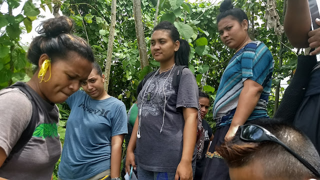
Behind me in the sun Rayden, Heather and Myra.


One group was found walking around the gym parking lot. Yummy had the GPS but had missed out on the explanation on Monday. If one selects the default screen on a Garmin etrex 10, one winds up in the map mode. The arrow points in the direction in which one is traveling. Yummy attempted to follow this arrow with her partners Saileen and Benter following along. There are no numbers on the mapping screen, thus this approach is puzzling at best, but this is certainly not the first time a group has followed an arrow found on a screen on the GPS. On Monday I had noted that the Compass screen included a latitude and longitude information.
Rain inveighed against photos from the laboratory exercise on Thursday. Both classes walked East from 158° 09.600' on the North 6° 54.570' line of latitude, recording the arcminutes every thirty meters out to 180 meters. This put the students out around 158° 09.698' The students then walked on out to 158° 09.700'.

Data from one GPS in the morning with an 1842 meter per arcminute slope.

At 11:00 rain kept two of the older GPS units from securing a signal. The newer units were able to track satellites.


The hill was very small but steep, providing a natural barrier to locating me. One would not accidentally stumble on me, one had to assault the hill directly. When walking north on a line of longitude one encounters the steeper side of the hill.

The location was sunny and a tad warm, and an umbrella was not practical as it might be seen over the Ischaemum polystachyum "reh padil" grass.
By 12:20 I could hear students in the area - I knew the initial find would be fast as I was not deep in the forest this term. I was counting on the hill to delay the searchers. And delay the hill did. One student even saw my entry path, the tamped down grass on the north (back) side of the hill, and ignored that sign, wandering off while convincing themselves that I had to be somewhere else, not there.

Venister, first to find me
The groups would get close, and then I would hear something along the lines of, "He must be over this way," and then they would head off in another direction. The groups did not place full faith and trust in their GPS and simply follow the numbers to my location. Venister, first to find me, noted that the north number did not match until he went up the hill, until he reached me.

Flora, Claire, and Gregorlyn followed in the wake of Venister
Prior to Venister's arrival, some of the groups sounded like they were probably within a few meters of my position. By laying down in the grass on top of the hill I was essentially invisible even from very close by. As a hiding place, this worked surprisingly well, at least as well as hiding out in the vale southwest of the gym.

Role was taken in part by photographs, Selihter and Arleen appear on top of the hill.

Brought in as an expert navigator, Mitchell Marina showed up with a GPS.

Margret Paul joined the group.

Lefreeancy found her way around to the less steep side of the knoll.

Suzanne and Tulpe check their GPS to see if the numbers match.

Behind me in the sun Rayden, Heather and Myra.


One group was found walking around the gym parking lot. Yummy had the GPS but had missed out on the explanation on Monday. If one selects the default screen on a Garmin etrex 10, one winds up in the map mode. The arrow points in the direction in which one is traveling. Yummy attempted to follow this arrow with her partners Saileen and Benter following along. There are no numbers on the mapping screen, thus this approach is puzzling at best, but this is certainly not the first time a group has followed an arrow found on a screen on the GPS. On Monday I had noted that the Compass screen included a latitude and longitude information.
Rain inveighed against photos from the laboratory exercise on Thursday. Both classes walked East from 158° 09.600' on the North 6° 54.570' line of latitude, recording the arcminutes every thirty meters out to 180 meters. This put the students out around 158° 09.698' The students then walked on out to 158° 09.700'.

Data from one GPS in the morning with an 1842 meter per arcminute slope.

At 11:00 rain kept two of the older GPS units from securing a signal. The newer units were able to track satellites.


Comments
Post a Comment