Latitude and longitude
Coverage of latitude and longitude began on Monday with a globe and an introduction to latitude and longitude on the planet earth. This term I did not focus on what is at the prime meridian at North 6° 54' and this would play out as dropping the Ghana angle. This would work well on Thursday as this term the classes did not return to A101 after taking data. Data was analyzed in the field with the aid of the new Tripltek tablet.
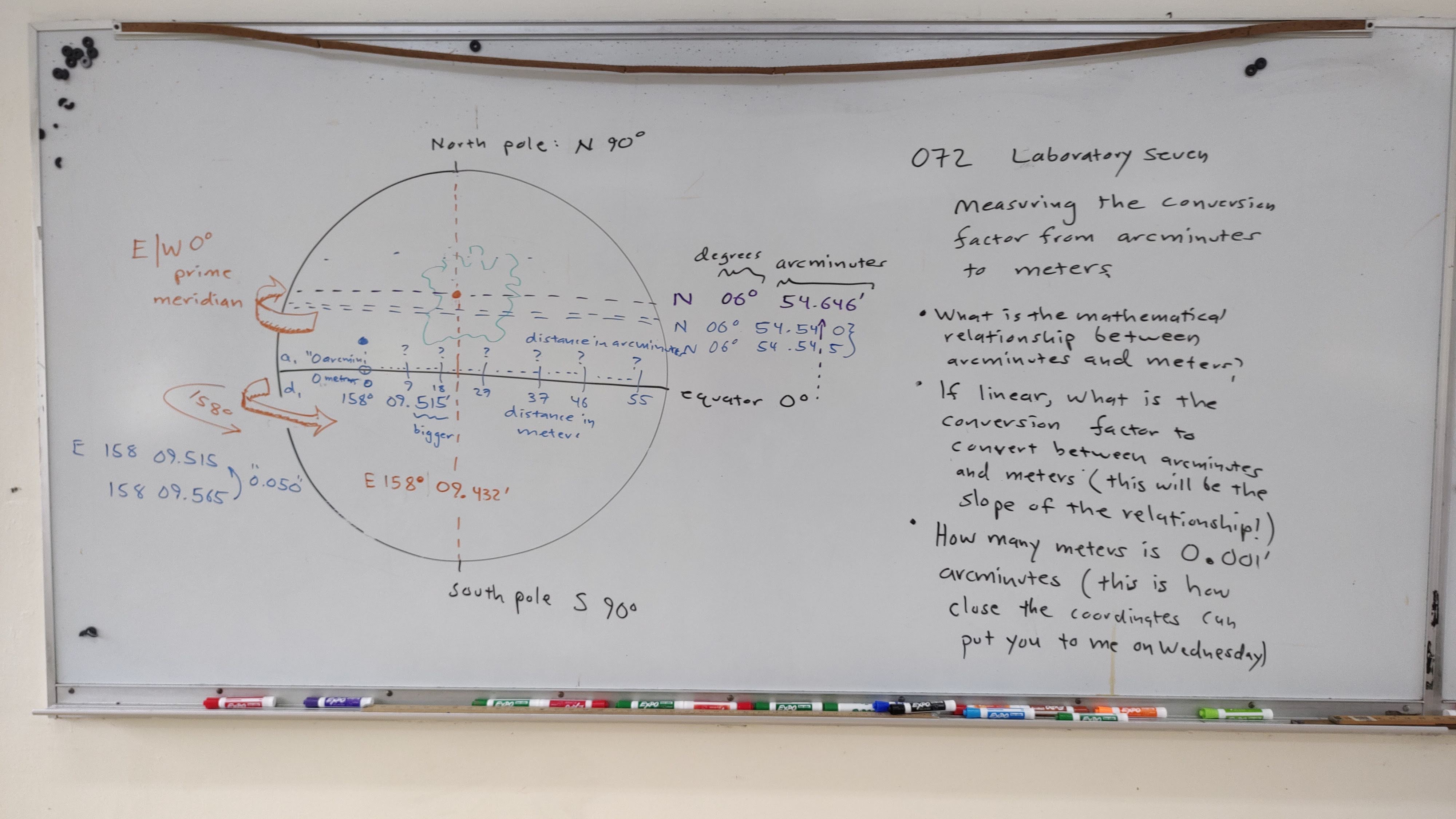
Wednesday hide and seek returned to N 06° 54.646' E 158° 09.432' (N 06.910760 E 158.157188) behind the IT shop.


Reagan and Sean used a GPS, Alexander used an app on his phone.


Myena checks the accuracy of her GPS, Malisa in the background


I could not provide start coordinates - I had no idea what they would be. Thursday morning saw heavy rain, heavier than anything previously encountered. I knew the walkway from LRC to A was problematic because it wasn't oriented east and west. The walkway from administration to the dining hall, however, is close to an east-west orientation. So the 8:00 class headed down there.

Myena


I put together a quick conversion table to obtain the metric measurements.


Myena entering data directly into Desmos

60 feet

90 feet

120 feet

150 feet

By using the stairs, I obtained 180 feet

180 feet

Analyzing the data in the field
After gathering the data I realized that backing up a few feet would have made 180 feet possible without winding up on the stairs.

Although the weather was improving, the lawn was a swamp. This led to the decision to rerun the lab along the same stretch of sidewalk.


Rosie-Rita, Fredson, Kiora, Jocela, Reagan, and Joe Scott
The class would start from back here and hit 180 feet just before the stairs to the east. Data analysis was done at tables alongside the sidewalk.


Comments
Post a Comment