On Monday I introduced latitude and longitude. For some students this is review, but for a surprising number there is simply no prior knowledge. They have heard of the equator as a word and concept, along with the north and south poles, but beyond that there is no familiarity with latitude and longitude. Bringing the concepts home onto campus no student is certain which way latitude and longitude run in the classroom. The few who ventured to answer suggested that some run up and down, some run right and left. No one realized that they form a two dimensional horizontal grid in the classroom, nor which runs which way. The location of the prime meridian was also unknown, although once I mentioned the name Greenwich a couple students recognized the term. I did not get the impression that anyone knew that Greenwich was a neighborhood in London, England.
Wednesday was set up so that in case of rain we would watch one of the Men of Rock videos, probably the second in the series. In case of good weather, latitude and longitude seek. The weather held and the class used GPS units and coordinates to find me at N 06° 54.646' E 158° 09.432'.
Mercedes was lead on the first two groups to arrive, which arrived together from the east.
Lailani, Adriann, and Josephine were also navigating. Lailani in front, Adriann with the GPS, Josephine third in line.
Herna
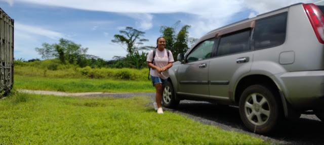
Herna and Keiko-Lalii's ride to campus happened to drop them off at the back of the building where I was, so they were technically the first to arrive, but did not navigate to the location.
Keiko-Lalii
Mercedes checking to see if the coordinates match: they do not
This is where the coordinates match: leading to the question of how much error in location is there based on the last digit of the display?
Derisalynn, Marcia, and Cynthia arrived from the West
Marcia was the navigator using an app on her phone
Melrose arrived next with Mikie from the East
Destiny Grace and Faithlyn also arriving from the east
Johannes came in with Faithlyn and Destiny from the East, Melrose is checking the accuracy of the coordinates
The issue of accuracy then dovetails into laboratory seven the next day.
Johannes and Derisalynn take an arcminute reading at 30 meters.
Marcia checks the GPS, Mercedes records data values. The class is walking on the North 6° 54.570' line of latitude and began at East 158° 09.600'
A third group included Adriann, Lailani, and Cynthia.
Derisalynn takes a reading at 90 meters.
The college lawn included a new addition from last night.
At 180 meters the groups are very close to 0.100 arcminutes since the start of the latitude walk. One group was at 158° 09.700' at the 180 mark.
Cynthia checks to see if she has reached 158° 09.700'
Adriann records data during the 8:00 class.
In the 11:00 section Herna and Melrose compare GPS data.
Destiny, and Faithlyn check the distance covered in arcminutes at 120 meters.
Keiko-Lalii arrives
The class went immediately into the field as the weather was amenable at 8:00 and 11:00. I did forget to bring a hat, and at 11:00 the sun was particularly sharp. Upon return to the classroom then I explained what we had just done.
I then used the rig at the back of the room running Google Earth to show where I was on Wednesday, what is at North 6° 54.570' and East 0° 00.000', the photos from there, and where Greenwich is actually located.
I wrapped up by covering some laboratory write-up notes.
The data below is actually a mix of values from different groups in the 8:00 and 11:00 class, these were also shown on the back television.


Comments
Post a Comment